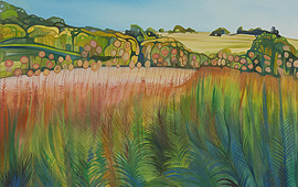
The Avebury Beeches
View details: Buy a Giclee Print, A3, A4 & A5
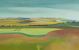
View from Smeathes Ridge
View details: Buy a Giclee Print, A2, A3, A4 & A5
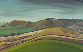
Whitefield Hill
View details : Buy a Giclee Print, A2, A3, A4 and A5
The Liddington Climb: SOLD
Lammy Down
View details : Buy a Giclee Print, A4 and A5
Towards Uffington: SOLD
The Thames Valley Sweep
View details : Buy a Giclee Print, A1, A2, A3, A4 and A5
The Devils Punchbowl
View details : Buy a Giclee Print, A2, A3,A4 and A5
Bury Down: SOLD
View details : Buy a Giclee Print, A1, A2, A3,A4 and A5
Towards Lowbury Hill: SOLD
View details
From Roden Downs: SOLD
Streatley Warren: SOLD
Towards South Stoke
View details : Buy a Giclee Print, A3, A4 and A5
Barnes Mill Pond
Swans Way
Grims Ditch
Nuffield Hills
View details : Buy a Giclee Print,A3, A4 and A5
Beacon Hill
Whiteleaf Cross
View from Lodge Hill
Fugsdon Wood: SOLD
Looking over Ellesborough
Towards Ivinghoe Beacon: SOLD
Incombe Hole